Weymouth: Making Safe Routes for Seniors
by Nicholas Bulens, Grant Writer & Researcher, Town of Weymouth
In the summer of 2014, WalkBoston partnered with the Town of Weymouth to open a conversation between municipal staff and older adults about creating a safer, more attractive walking environment. The Safe Routes for Seniors initiative was a true convergence of advocacy and policy, resulting in a set of design guidelines and program alternatives to better coordinate the town’s
capital planning process with greater walkability. The initiative has helped springboard Weymouth toward a healthier approach to community design.
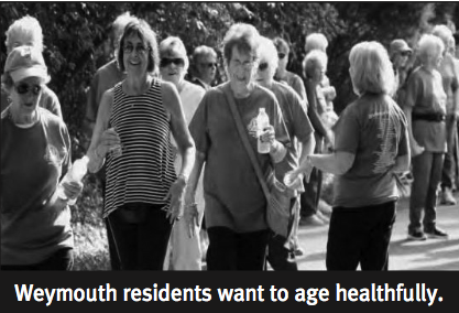
Weymouth is a mature suburban community situated about 12 miles southeast of Boston. The town has a strong residential character with many attributes of a walkable environment. Weymouth has four village centers, each featuring a mix of land uses that helps create a sense of place for residents. It also has a diverse open space network interspersed among many settled neighborhoods. There is also a good mix of transit services, including commuter rail and bus, which help connect Weymouth’s people and places. However, in spite of these attributes, the town has grown increasingly dependent on the automobile for transportation in the last 50 years. Simultaneously, Weymouth’s population has aged and diversified to where almost one in every four residents is over age 60.
Recognizing a need to analyze the built environment from a healthy aging perspective, Weymouth received a grant from the Massachusetts Council on Aging, in partnership with the Massachusetts Department of Public Health [MDPH], to conduct a senior pedestrian safety study. Municipal staff collected data on Weymouth’s housing, land use and pedestrian crashes. The data led the town to identify four areas of need where seniors could most benefit from improved walking conditions.
WalkBoston facilitated a public meeting between municipal staff and an audience of over 30 older adults. Residents raised important concerns about poorly maintained sidewalks, obstructed lines of sight and distressed crosswalks. WalkBoston then hit the streets with a diverse focus group of municipal staff, senior residents and local businesspeople. A wealth of observations were made, and ideas flowed freely between stakeholders.
Weymouth’s walkability investigation culminated in the publication of the Safe Routes for Seniors Design Guidelines and Planning Report. WalkBoston introduced municipal staff to new and innovative approaches to streetscape improvements, including “lighter quicker cheaper” placemaking, which could facilitate safer, more frequent foot traffic by older adults in the town’s target areas. Weymouth’s planning staff prepared the final report to summarize the initiative’s findings and recommend design guidelines for town planning moving forward.
The Safe Routes for Seniors initiative has already led Weymouth to take a number of steps toward enhancing walkability. For 2015, Weymouth’s Mayor Susan Kay has committed $150,000 to sidewalk improvements and indicated that she will budget up to $250,000 for the same purpose each year thereafter. Plans are also under way by municipal staff to develop a Complete Streets policy and apply for certification under the MassDOT’s new Complete Streets program. In addition, the town has received a technical assistance grant from the MDPH to develop a zoning action plan with the Pioneer Valley Planning Commission [PVPC], a leader in the movement to design healthier communities. The PVPC will advise Weymouth on how to facilitate healthy eating and more physical activity in the community through changes to local zoning provisions, such as reduced parking requirements and site plan review.
This article was featured in our Summer 2015 newsletter. See the full newsletter & past editions here.
——————————————————————————————————————-
Join our Mailing List to keep up to date on advocacy issues.
Like our work? Support WalkBoston – Donate Now!
Connect with us on Twitter and Facebook